"Seoul - 5.5 Restoration of the Destructed Ecological Environment"의 두 판 사이의 차이
잔글 |
|||
| 2번째 줄: | 2번째 줄: | ||
The damages on the natural landscape of Seoul began due to constructions of houses to relieve the housing shortage and improve infrastructures like roads and schools during the chaotic modernization period after the Liberation and the Korean War. Until the 1960s, before the full-scale development began, the areas south of the Han River was mostly forests but the green areas shrank dramatically due to the large-scale development in 1985. In 1995 forest areas that are efficient as green areas decreased in size, and the green areas with relatively low efficiency such as urban parks and green areas increased. The story is identical in 2005; the size of urban green is on the rise. | The damages on the natural landscape of Seoul began due to constructions of houses to relieve the housing shortage and improve infrastructures like roads and schools during the chaotic modernization period after the Liberation and the Korean War. Until the 1960s, before the full-scale development began, the areas south of the Han River was mostly forests but the green areas shrank dramatically due to the large-scale development in 1985. In 1995 forest areas that are efficient as green areas decreased in size, and the green areas with relatively low efficiency such as urban parks and green areas increased. The story is identical in 2005; the size of urban green is on the rise. | ||
| − | |||
| − | |||
| − | |||
| − | |||
| − | |||
| − | |||
| − | |||
| − | |||
| − | |||
Not only did the size of forest area become smaller but the forest’s ecosystem was also devastated because microorganisms in the soil disappeared as a consequence of acidification induced by air pollution. The forest community structure transformed and the energy level of the forest decreased as the average temperature increased along with the air pollution level. Native plants decreased in number and non-native plants such as ragwood, eupatorium rugosum houtt, phytoiacca americana and ailanthus altissima began to spread rapidly. The Seoul Metropolitan Government launched projects aimed at protecting biodiversity and preserving ecological resources through systematic management of the forest namely in the form of the Preservation of Habitats for Wild Animals Project, the Ecological Axis Connection Project and the Urban Ecological Forest Creation Project. First, the city government designated the Ecological Landscape Preservation Areas (a total of 17 areas or 4,807,327 square meters) based on sample group areas of ecosystem. Some habitats for migratory birds, wild animal areas and reed fields were designated as the Wildlife Preservation Areas (total 9 areas), and the government promoted the preservation of the natural ecosystem, landscape and endangered species. Also under progress is the Ecological Green Axis Restoration Project, which connects the disconnected sections produced by road constructions in the ecological paths in the green ring that surrounds Seoul (12 places). In order to build a green network that elevates the city’s competitiveness other projects were also put in place such as the 10 Million Tree of Life Planting Movement of 1998, the Forest of Hope Creation Project, and continuous everyday living space forestation projects such as creating gardens on rooftops of buildings in downtown, forestation of the streets, creation of open green areas in apartment complexes, planting trees on walls, forestation of left-over pieces of land and creating parks in schools. | Not only did the size of forest area become smaller but the forest’s ecosystem was also devastated because microorganisms in the soil disappeared as a consequence of acidification induced by air pollution. The forest community structure transformed and the energy level of the forest decreased as the average temperature increased along with the air pollution level. Native plants decreased in number and non-native plants such as ragwood, eupatorium rugosum houtt, phytoiacca americana and ailanthus altissima began to spread rapidly. The Seoul Metropolitan Government launched projects aimed at protecting biodiversity and preserving ecological resources through systematic management of the forest namely in the form of the Preservation of Habitats for Wild Animals Project, the Ecological Axis Connection Project and the Urban Ecological Forest Creation Project. First, the city government designated the Ecological Landscape Preservation Areas (a total of 17 areas or 4,807,327 square meters) based on sample group areas of ecosystem. Some habitats for migratory birds, wild animal areas and reed fields were designated as the Wildlife Preservation Areas (total 9 areas), and the government promoted the preservation of the natural ecosystem, landscape and endangered species. Also under progress is the Ecological Green Axis Restoration Project, which connects the disconnected sections produced by road constructions in the ecological paths in the green ring that surrounds Seoul (12 places). In order to build a green network that elevates the city’s competitiveness other projects were also put in place such as the 10 Million Tree of Life Planting Movement of 1998, the Forest of Hope Creation Project, and continuous everyday living space forestation projects such as creating gardens on rooftops of buildings in downtown, forestation of the streets, creation of open green areas in apartment complexes, planting trees on walls, forestation of left-over pieces of land and creating parks in schools. | ||
| 16번째 줄: | 7번째 줄: | ||
<gallery align="center" widths="300px" heights="400px"> | <gallery align="center" widths="300px" heights="400px"> | ||
| − | |||
File:UKS04_Seoul_img_46.jpg|Photo 15 Forestation of Roadside Cutting Area | File:UKS04_Seoul_img_46.jpg|Photo 15 Forestation of Roadside Cutting Area | ||
| − | |||
</gallery> | </gallery> | ||
The increase of urban green areas that started after the 1990s is credited to the restoration of green areas near mountains and the conversion of brown fields that were damaged during the industrialization era into parks. First of all, as the 1990s dawned, the areas near Pil-dong (79,937 square meters), used as the Japanese Military Headquarters during the Japanese Occupation and later used as the Capital Defense Command, was converted into Namsangol Hanok Village. The converted village served as the catalyst for the launch of ‘Restoration of Namsan’ Citizen’s Campaign, which aimed to restore Seoul’s symbolic landscape of Namsan. In 1994, as a part of the 600-Year Anniversary of the Capital Designation Project, the Foreigners’ Apartment Complex, which used to block the view of Namsan, was demolished and converted into a park. The Namsan Renaissance Plan was established in 2009 and the following projects were launched: the recovery of historicity through the restoration of fortress walls and the recovery of geographical features; the improved accessibility to Namsan; the restoration of ecosystem; and the improved view of Namsan’s landscape. Nowadays, through these projects Namsan has regained its original form as a symbolic historical space and a place where citizens often visit to relax as well as serve as one of the most visited tourist spots. | The increase of urban green areas that started after the 1990s is credited to the restoration of green areas near mountains and the conversion of brown fields that were damaged during the industrialization era into parks. First of all, as the 1990s dawned, the areas near Pil-dong (79,937 square meters), used as the Japanese Military Headquarters during the Japanese Occupation and later used as the Capital Defense Command, was converted into Namsangol Hanok Village. The converted village served as the catalyst for the launch of ‘Restoration of Namsan’ Citizen’s Campaign, which aimed to restore Seoul’s symbolic landscape of Namsan. In 1994, as a part of the 600-Year Anniversary of the Capital Designation Project, the Foreigners’ Apartment Complex, which used to block the view of Namsan, was demolished and converted into a park. The Namsan Renaissance Plan was established in 2009 and the following projects were launched: the recovery of historicity through the restoration of fortress walls and the recovery of geographical features; the improved accessibility to Namsan; the restoration of ecosystem; and the improved view of Namsan’s landscape. Nowadays, through these projects Namsan has regained its original form as a symbolic historical space and a place where citizens often visit to relax as well as serve as one of the most visited tourist spots. | ||
| − | |||
| − | |||
| − | |||
| − | |||
| − | |||
| − | |||
| − | |||
Most typical examples of transforming brownfield damaged during the industrialization era into green field include the conversion of old factory sites created by the policy that required relocation of factories and polluters out of the metropolitan area; and the conversion of old water purification facility site and abandoned railroad track sites into parks. For instance Yeongdeungpo Park used to be the site of OB Brewing Company. When OB Brewing Company relocated out of the industrial area of Yeongdeungpo in 1997, the Seoul Metropolitan Government purchased the site at 195,700,000,000 won and paid 12,000,000,000 won for the construction to convert it into a park. The brew copper was kept as the park’s landmark. Similarly Seonyudo Park and Seoseoul Lake Park are recycled water purification facility sites where the main spaces of the water purification facility such as the settling pond and the filtering basin were converted to maintain ecological continuity. Nanjido Noeul Park used to be a 95meter high ‘mountain of garbage’ created by trash collected from Seoul over 15 years beginning from 1978. The park is about 340,000 square meters in size and opened in 2008. The ecosystem and various plants and animals are coming back to life after several years of stabilization efforts to process the methane gas and leachate produced by trash that accumulated in this site until 1991. Besides these large-scale park projects, smaller projects that target procurements of green areas within the districts are thriving. As the railways (Gyeonguiseon and Gyeongchunseon Lines) that crossed the downtown area became either double-tracks or went underground, the abandoned railroad track sites were converted into linear parks. Creation of small parks in cooperation with residents in their communities is also at work wherein leftover pieces of lands are turned into village yards and old children’s park are converted into ‘Children’s Imagination Park.’ | Most typical examples of transforming brownfield damaged during the industrialization era into green field include the conversion of old factory sites created by the policy that required relocation of factories and polluters out of the metropolitan area; and the conversion of old water purification facility site and abandoned railroad track sites into parks. For instance Yeongdeungpo Park used to be the site of OB Brewing Company. When OB Brewing Company relocated out of the industrial area of Yeongdeungpo in 1997, the Seoul Metropolitan Government purchased the site at 195,700,000,000 won and paid 12,000,000,000 won for the construction to convert it into a park. The brew copper was kept as the park’s landmark. Similarly Seonyudo Park and Seoseoul Lake Park are recycled water purification facility sites where the main spaces of the water purification facility such as the settling pond and the filtering basin were converted to maintain ecological continuity. Nanjido Noeul Park used to be a 95meter high ‘mountain of garbage’ created by trash collected from Seoul over 15 years beginning from 1978. The park is about 340,000 square meters in size and opened in 2008. The ecosystem and various plants and animals are coming back to life after several years of stabilization efforts to process the methane gas and leachate produced by trash that accumulated in this site until 1991. Besides these large-scale park projects, smaller projects that target procurements of green areas within the districts are thriving. As the railways (Gyeonguiseon and Gyeongchunseon Lines) that crossed the downtown area became either double-tracks or went underground, the abandoned railroad track sites were converted into linear parks. Creation of small parks in cooperation with residents in their communities is also at work wherein leftover pieces of lands are turned into village yards and old children’s park are converted into ‘Children’s Imagination Park.’ | ||
| − | |||
| − | |||
| − | |||
| − | |||
| − | |||
| − | |||
2017년 1월 13일 (금) 00:49 판
The Joseon Dynasty chose its capital based on the fengshui principle and strictly banned any quarrying, logging or building of houses in order to protect the veins of the mountains in and out of the capital city through the Prohibition Orders. Because of this Prohibition Order the forests around Seoul were filled with thick, healthy trees, and the mountain paths where the animals roam and materials were carried were preserved. The ecological security was maintained, and the beauty of the forests was recognizable in everyday life.
The damages on the natural landscape of Seoul began due to constructions of houses to relieve the housing shortage and improve infrastructures like roads and schools during the chaotic modernization period after the Liberation and the Korean War. Until the 1960s, before the full-scale development began, the areas south of the Han River was mostly forests but the green areas shrank dramatically due to the large-scale development in 1985. In 1995 forest areas that are efficient as green areas decreased in size, and the green areas with relatively low efficiency such as urban parks and green areas increased. The story is identical in 2005; the size of urban green is on the rise.
Not only did the size of forest area become smaller but the forest’s ecosystem was also devastated because microorganisms in the soil disappeared as a consequence of acidification induced by air pollution. The forest community structure transformed and the energy level of the forest decreased as the average temperature increased along with the air pollution level. Native plants decreased in number and non-native plants such as ragwood, eupatorium rugosum houtt, phytoiacca americana and ailanthus altissima began to spread rapidly. The Seoul Metropolitan Government launched projects aimed at protecting biodiversity and preserving ecological resources through systematic management of the forest namely in the form of the Preservation of Habitats for Wild Animals Project, the Ecological Axis Connection Project and the Urban Ecological Forest Creation Project. First, the city government designated the Ecological Landscape Preservation Areas (a total of 17 areas or 4,807,327 square meters) based on sample group areas of ecosystem. Some habitats for migratory birds, wild animal areas and reed fields were designated as the Wildlife Preservation Areas (total 9 areas), and the government promoted the preservation of the natural ecosystem, landscape and endangered species. Also under progress is the Ecological Green Axis Restoration Project, which connects the disconnected sections produced by road constructions in the ecological paths in the green ring that surrounds Seoul (12 places). In order to build a green network that elevates the city’s competitiveness other projects were also put in place such as the 10 Million Tree of Life Planting Movement of 1998, the Forest of Hope Creation Project, and continuous everyday living space forestation projects such as creating gardens on rooftops of buildings in downtown, forestation of the streets, creation of open green areas in apartment complexes, planting trees on walls, forestation of left-over pieces of land and creating parks in schools.
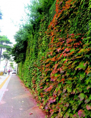
Photo 15 Forestation of Roadside Cutting Area

The increase of urban green areas that started after the 1990s is credited to the restoration of green areas near mountains and the conversion of brown fields that were damaged during the industrialization era into parks. First of all, as the 1990s dawned, the areas near Pil-dong (79,937 square meters), used as the Japanese Military Headquarters during the Japanese Occupation and later used as the Capital Defense Command, was converted into Namsangol Hanok Village. The converted village served as the catalyst for the launch of ‘Restoration of Namsan’ Citizen’s Campaign, which aimed to restore Seoul’s symbolic landscape of Namsan. In 1994, as a part of the 600-Year Anniversary of the Capital Designation Project, the Foreigners’ Apartment Complex, which used to block the view of Namsan, was demolished and converted into a park. The Namsan Renaissance Plan was established in 2009 and the following projects were launched: the recovery of historicity through the restoration of fortress walls and the recovery of geographical features; the improved accessibility to Namsan; the restoration of ecosystem; and the improved view of Namsan’s landscape. Nowadays, through these projects Namsan has regained its original form as a symbolic historical space and a place where citizens often visit to relax as well as serve as one of the most visited tourist spots.
Most typical examples of transforming brownfield damaged during the industrialization era into green field include the conversion of old factory sites created by the policy that required relocation of factories and polluters out of the metropolitan area; and the conversion of old water purification facility site and abandoned railroad track sites into parks. For instance Yeongdeungpo Park used to be the site of OB Brewing Company. When OB Brewing Company relocated out of the industrial area of Yeongdeungpo in 1997, the Seoul Metropolitan Government purchased the site at 195,700,000,000 won and paid 12,000,000,000 won for the construction to convert it into a park. The brew copper was kept as the park’s landmark. Similarly Seonyudo Park and Seoseoul Lake Park are recycled water purification facility sites where the main spaces of the water purification facility such as the settling pond and the filtering basin were converted to maintain ecological continuity. Nanjido Noeul Park used to be a 95meter high ‘mountain of garbage’ created by trash collected from Seoul over 15 years beginning from 1978. The park is about 340,000 square meters in size and opened in 2008. The ecosystem and various plants and animals are coming back to life after several years of stabilization efforts to process the methane gas and leachate produced by trash that accumulated in this site until 1991. Besides these large-scale park projects, smaller projects that target procurements of green areas within the districts are thriving. As the railways (Gyeonguiseon and Gyeongchunseon Lines) that crossed the downtown area became either double-tracks or went underground, the abandoned railroad track sites were converted into linear parks. Creation of small parks in cooperation with residents in their communities is also at work wherein leftover pieces of lands are turned into village yards and old children’s park are converted into ‘Children’s Imagination Park.’