V. Gangwon-do
Geography of Korea: V. Gangwon-do
V. Gangwon-do
The name “Gangwon” (the suffix “do” meaning “province”) was coined in the early fifteenth century as a combination of the “Gang” from Gangneung, a major provincial city on the province’s eastern coast, and the “won” from Wonju, another provincial city in the province’s western region. The province can effectively be divided into eastern and western portions, traditionally termed Yeongdong (“east of the passes”) and Yeongseo (“west of the passes”), respectively, with the Yeongdong region referring to the coastal portion lying to the east of the north-south running Taebaeksanmaek range and its high point at Daegwannyeong (832 meters), and with the Yeongseo region referring to the area to the west of this line.
As of 2013, the population of Gangwon-do was 1.54 million, or about 3 percent of the total population of South Korea, making it along with Jeju-do (whose population is about 1.2 percent of the total) one of the country’s two least populated provinces. However, with a total land area of 16,830 sq. km. (or 16.8 percent of the land area of South Korea), it is along with Gyeongsang-do and Jeolla-do provinces one of the three largest provinces in terms of size. Large in area and small in population, the population density of Gangwon-do is about 91.6 persons/sq. km., the lowest population density of the country’s seventeen autonomous governing regions (the average overall density of South Korea is 510.1 persons/sq. km.). Clearly the major factor behind such a low population density are the mountains the cover the province. Gangwon-do also has about 13,804 sq. km. of forested area, or slightly more than one-fifth (or 21.5%) of the country’s total forested area (64,176 sq. km.).
The geological features of Gangwon-do’s southeast are widely formed by layers of the Joseon Supergroup and Pyeongan Supergroup which deposited large quantities of high-quality limestone. Gangwon-do and neighboring Chungcheongbuk-do provinces are primary producers of the country’s limestone, and it is estimated their mines can continue to be productively mined for another two millennia. Accordingly, the cement industry had developed in Gangwon-do, while the region is also full of karst topography, such as the massive limestone cave of Hwanseongul (Natural Treasure No. 178). The Pyeongan Supergroup that encompassed the entire area around Jeongseon and Taebaek in Gangwon-do also resulted in buried coal deposits. Though limestone and coal constituted Gangwon-do’s most important natural resources from the advent of the twentieth century, the 1980s began to see the closure of almost all the country’s coal mining industries. In the province’s Jeongseon county, the town of Sabuk-eup, once famed for its coal mining, has been transformed into a tourist destination with the development of the Kangwon Land casino and resort.
Gangwon-do’s most prominent feature is the peninsula’s most rugged mountain terrain, an elongated range stretching in a north-south alignment along the east coast. The Taebaeksanmaek range rises abruptly on its eastern side but has a more gradually sloping western face. Viewed from the East Sea, the range presents a truly magnificent sight. Because of the range’s sheer eastern face, the terrain of the province’s Yeongdong region drops abruptly towards the shoreline, resulting in sparse plains, rivers that are short and fast moving, and a limited basin area.
The Taebaeksanmaek range’s watersheds are distributed among high peaks such as the mountains of Seorak (1708m), Odae (1563m), Duta (1353m), and Taebaek (1567m), but to the west of these can also be found high peaks in excess of a thousand meters, such as Gyebang (1577m), Gariwang (1561m), Duwibong (1466), Taegi (1261m), and Chiak (1288m). Besides these, Gangwon-do also has some smaller peaks that have long been renowned as mountain passes, such as Daegwallyeong (832m), Hangyeryeong (920m), Misiryeong (767m), Jingogae (940m), and Jinburyeong (520m), all of which separate the Yeongdong from the Yeongseo regions (i.e., eastern and western) Gangwon-do province.
In the Yeongseo region of Gangwon-do the land rises more gently. Even terrain at over 700 meters above sea level has very gentle slopes and a topography of “high, flat summits” that can still be developed. Because of such natural geological features, the Yeongseo region has long attracted slash-and-burn farmers, and with the development of transportation the region’s cooler elevations became famed for their production of Chinese cabbages in summertime that could then be readily moved to market. From the 1990s the sports and leisure industry began to develop in earnest and one aspect of this were ski resorts in the Yeongseo region. Of particular note are the Alps Ski Resort in Jinburyeong and the Yongpyeong Ski Resort in Daegwallyeong, which were the first ski slopes to open in Korea.
Due to its coastal position, the Yeongdong region has on average temperatures 2˚C higher than those of the western Yeongseo region. And in terms of average annual precipitation, the Yeongdong region receives about 2000–2100mm annually, some 300–400mm more than Yeongseo (1600–1700mm). Gangwon-do receives more snowfall than any other region of the country, recording winter snowfall rates much higher than other areas. Some areas of the Taebaeksanmaek Range in particular have experienced heavy snowfalls of 1–2 meters. The province’s Pyeongchang county was recently selected as the host of the 2018 Winter Olympics.
With some 80 percent of its land area covered mountains, only 9.6 percent of Gangwon-do’s territory is arable land, the lowest rate of any province. Of this, about 6.2 percent is given over to dry field cultivation while about half that (3.4%) is paddy field, but with the recent growth in arable land, the rate of dry field is increasing. Dry field crops include corn and potatoes as well vegetables like radish and varieties of cabbage. Of particular note is the highland Chinese cabbage grown in those regions at an elevation of around a thousand meters. Cultivated in the relatively cool climate such elevations enjoy even in summer, it is something not found in other areas and has become an important cash crop for local farmers.
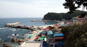
The offshore area of eastern Gangwon-do have long been recognized as providing ideal fishing grounds due to the intersection there of cold and warm ocean currents. However, due to recent global warming, fishing catches there have been declining. Though Gangwon-do’s East Sea coast is known for its superior pollack (which are frozen or dried) and squid, these days most supplies of these are reliant upon imports. In terms of fishing ports, important in Gangwon-do are Sokcho, Jumunjin, Mokho, Samcheok, and Geojin, though in fact the province is dotted with small and sleepy ports that can reward the visitor with their picturesque beauty.
As of 2014 Gangwon-do has 7 cities and 11 counties. Including the provincial seat of Chuncheon, the seven cities include Wonju, Sokcho, Gangneung, Donghae, Taebaek, and Samcheok. Among these, Sokcho, Gangneung, Donghae, and Somcheok are located on the East Sea coast. Although the Yeongdong region of the province is fairly narrow, it is more urbanized relative to the western Yeongseo region. Traditionally Gangneung and Wonju were the province’s large cities, but with its establishment as the provincial capital in 1910, Chuncheon grew to be a major city. Gangwon-do’s counties are Hongcheon, Hwangseong, Yeongwol, Pyeongchang, Jeongseon, Cheolwon, Hwacheon, Yanggu, Inje, Goseong, and Yangang.
The most populous place in Gangwon-do is Wonju city with 311,000 people, followed by the provincial capital of Chuncheon with 276,000. Wonju’s status as the largest city in Gangwon-do owes much to the development of national highways, beginning with the Yeongdong and Jungang Expressways, that pass through Wonju, which greatly increased that city’s accessibility to Seoul. None of the other cities or counties of the province surpass 100,000 in population. Indeed, with the exception of Hongcheon county, none of the other ten counties even reach 20,000 in population.
Highly mountainous, with little industry, and with an extensive coastline, Gangwon-do is the country’s premier tourist destination, offering locales from Seoraksan National Park to an eastern coast dotted every few kilometers with swimming beaches. It is practically a truism to say that half of Koreans spend their summer holidays in Gangwon-do. In addition to the Yeongdong Expressway that opened in 1975 (which runs Seoul-Wonju-Daegwalleong-Gangneung), a number of other roads connecting east and west have been built such that from about the year 2000 tourism to the province increased significantly.
Gangwon-do’s northern border touches North Korea. Tourism trips to Mt. Geumgang (Kumgang) in North Korea by land depart from the province’s Goseong county. In such places as Cheorwon in Goseong county one is able to look down on the DMZ from observation platforms. Besides these, the province plenty to attract the international tourist, such Chuncheon’s spicy chicken, Namiseom Island, Gangchon village, Cheongpyeong Temple, Sokcho’s abai sundae (a North Korean-style sausage), the Hwajinpo lagoon, Gangneung’s Gyeongpo Lake area, Mt. Odae, the beachside town of Jeongdongjin, Naksan Temple, Hwaseon Cave in Samcheok, Haesindang Park, Mt. Taebaek outside the city of Taebaek, Kangwon Land in Jeongseon, and Mt. Jiak in Wonju.


